
Methodology for the Fieldwork
The fieldwork involved the realization of semi-structured interviews with persons with different kinds of disabilities. It began on the 19th of May and went on for 27 days in all the three selected sites. After a week-long training seminar trainees were divided into 6 teams, with one monitoring assistant and 2 monitors for each team. Two teams conducted the interviews in each of the three sites selected for the field study. All the monitors and monitoring assistants were provided with identity cards for the duration of the field study by the Principal Secretary, Women and Child Development, and Disabled Welfare Department, Government of Andhra Pradesh. The monitors were responsible for conducting the interviews, whereas the monitoring assistants were responsible for collecting the information regarding each of the sites, collect secondary data, and generally be of assistance to the monitors in identifying persons with disabilities to be interviewed.
Monitoring Sites
The three monitoring sites - Hyderabad, Kurnool and villages of three Mandals of Vishakapatnam District - were selected through a consultative process during the training seminar to reflect diversity in terms of population, geographical location, economic, social and cultural divide, and in terms of their distinct administrative identity. In this sense, Kurnool Town represents a semi-urban context, the villages of three Mandals of Vishakapatnam District stand for rural locations and Hyderabad provide the large urban setting. These three sites also represent the three distinct regions of the State, namely, Telangana, Rayalaseema and Coastal Andhra, respectively.
Town (Semi-Urban) - Kurnool Town
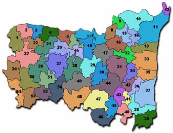
A map of Kurnool district in Andhra Pradesh state. Kurnool town is numbered 25.
Kurnool is a city in Kurnool district in Andhra Pradesh state of southern India. It is the administrative seat of Kurnool district. It is the former capital of Andhra State (not Andhra Pradesh), which was carved out of Madras State in 1953. The present day Andhra Pradesh was formed as a result of merger of Nizam (the Princely State of Hyderabad), Andhra, parts of Bombay, Madhya Pradesh, Orissa regions.
Kurnool as a village had existed for more than 2000 years. It is the only inhabited place between two rivers, of Tungabadra and Handri Rivers. After Indian Independence, the Kurnool Town was declared as a Capital City by the Andhra Government from 1st October 1953 and went on to be the Capital for 3 years, until 1st November 1956, by which time the Princely State of Hyderabad under the Nizams was brought under the control of the Union of India and then the Capital was shifted to Hyderabad, as it was considered to be more central to the State of Andhra Pradesh, under which the State of Hyderabad also came under. Kurnool Town was earlier known as Kandanavolu, which was changed to "Kurnool" when the British took over the town. In 12th century AD, the Odders, who carted stones for the construction of the temple Alampur, used the site on which the town now stands as a halting place before crossing the Tungabhadra and greased their cart wheels with oil locally supplied by some of the oil mongers, and called the place 'Kandanavolu', which literally means "lubricating village". Another story for the name of the erstwhile village goes that bullock carts that came from far-off places to dig sand in the two rivers (that ran on both sides of the village), used to stop by to lubricate their wheels.
Kurnool area was selected by the Parsis and Arabians as their trading and commercial capital in the 14th and 15th Centuries and they carried their trade from here and ruled the area. After some time, the Vijayanagara kings from the neighboring Karnataka took over the rule of this region. The representative of Vijayanagara Empire was Konda Reddy, who ruled the area as a King. There is still a grand citadel called Konda Reddy Buruju to testify the glory it enjoyed in Vijayanagara times, but it is not certain how the watchtower got its name. There are many famous temples in this Town, of Nagalingeshwara Swami or Shiva Temple, and other temples of Vishnu in his different Avatars. During the British Raj Kurnool expanded and schools, churches, etc. were built.
Kurnool Town is spread over an area of 49.73 Square Kilometers. It has an average elevation of 274 metres (898 feet). On the Eastern side, there is Nandi Kotkur Mandal, on the Western side there is Kallur Mandal, on the Northern side is the Kurnool Mandal, and on the Southern side there is Veldurthi Mandal. The Rivers that surround the Kurnool Town are Tungabadra, which is one of the largest rivers in the South India, K.C. Canal constructed by the State Government, and Handri River all of which irrigate this entire District, which is also named after the Town, of Kurnool. The Tomb of Abdul Wahab, one of the Kings of this area, was constructed right next to the Handri River. The last Ruler of the Kurnool Town was Gopala Raju.
Kurnool is connected to most cities and towns in Andhra Pradesh and to the Metropolises of Bangalore and Chennai by the Andhra Pradesh State Road Transport Corporation (APSRTC) and the Karnataka State Road Transport Corporation.(KSRTC). National Highway 7 connects Kurnool to Hyderabad (210 km, 4.30 hours), Anantapur (140 km, 3.00hours) and Bangalore (360 km, depending upon the nature of service, 6.00 to 9.00 hours). NH 18, junctions with National Highway No. 7 near Kurnool - Nandyal - Cuddapah - Junction with National Highway No. 4 near Chittoor is 369 km. For movement within Kurnool, car and auto rickshaw rentals are available.
According to the 2001 Central Census, the total population of Kurnool Town is 342,973 in total and of this the number of men is 174,190 and the number of women is 168,783. There are 52,682 families which have own houses. The growth rate of this Town is 24.55 per cent. Of this, 99,787 people in the Town live Below the Poverty Line. There are 4,536 persons with Disabilities living in Kurnool Town. The increase in rate of the rural population in this Town is 34.09 percent and the Town growth is at the rate of 13.65 percent.
There are 50 wards in the Kurnool Town. There are all the government services and facilities necessary for a Town like District Collectorate, Government Hospital, Railway Station, State Transport and other Government Offices. The National Highway No. 7 which goes from Hyderabad, the Capital City of Andhra Pradesh to Bangalore, the Capital City of the neighboring Karnataka State goes through the Kurnool Town.
There are people from all religions who live in this Town but the predominant religions are Hindus and Muslims who comprise 80% of the population and people of the other religions like Christians comprise the other 20%. Similarly, 80% of the people in the town belong to the Backward Classes whereas 20% belong to Scheduled Castes and Tribes. The temperatures in the Town tend to be moderate, with the best season being from January to March, when it is almost Spring like, it is neither hot or cold. From March to June is a very hot period, and from July onwards there are the monsoons till September and after that till December it is the Winter season. The maximum temperatures during Summers are around 44-45 degrees Centigrade and a minimum of 31 degrees Centigrade. At the same time, the day temperatures during Winter is around 32 degrees Centigrade and night temperatures hover around 18-19 degrees Centigrade. The average rainfall during Monsoons is around 704 mm.
According to the 2001 Census, there are 270,312 persons in the Town who are literate, of which men are 119,046 and women are 88,266. There are 9 Kindergarten and 9 Primary Schools in the Town. There are 6 major Private Schools. There are 9 Schools under the Municipality. There are 8 Zilla Parishad (District level) Schools, 8 Junior Colleges, 2 Graduate Colleges, 1 Medical College, and 1 Law College. There are 45 Banks in total in this Town, of which 34 are nationalized banks, Village Banks are 2, 2 Cooperative Banks and 7 Private Banks.
Other than the main language of Telugu, the people in this Town also speak Urdu, Hindi and English. Some of the crops which grow in and around this District which is also named after the Town are Paddy, Sorghum, groundnuts, sunflower, chili, onion and cotton. According to the 2005 estimates, 248,251 Quintals of Paddy and 204,616 Quintals of Sorghum were produced. Some of the most important sources of livelihood for the people in Kurnool Town is the Rayalaseema Paper Mill which is the biggest in all of Asia and Sri Rayalaseema Alkaloid and Allied Chemicals Factory and Carbide Factories. As this region of the state is known for its high levels of mineral resources, limestone and granite are the topmost minerals mined. There are thousands of quarries from where stone used for construction of buildings is blasted and broken down into rubble, which also offers lot of livelihoods for laborers.
As with any other developed or developing Town, Kurnool is also segregated along class lines as far as its inhabitants are concerned. Where Real Estate is the big business for the rich of this town, the poor and poorest depend majorly on labor work for their livelihood. The middle class is mostly involved in running the trade and commerce as well as employed in the various government and non-government agencies in the town. One of the major causes of disability in the Town is the high presence of Calcium in the ground water, which is often the only source of drinking water, especially for the lower and middle classes. Added to this is the lack of awareness regarding the necessity of medical aid which compounds in children being born with disabilities or accident victims having permanent impairments.
Village (Rural) – Ananthagiri, Araku Valley and Dumbriguda Mandals of Vishakapatnam District
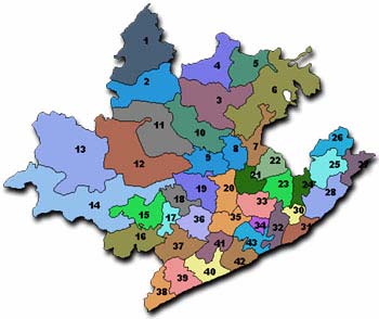
A map of Vishakapatnam district in Andhra Pradesh state. Dumbriguda is numbered 19, Arakuvalley is numbered 20 and Ananthagiri is numbered 21
Vishakapatnam or Vizag as it is known familiarly is the biggest city in this district, which is also named after the city. This is a fast developing city on the shores of the Bay of Bengal, the last few years seeing an unprecedented growth and development, as this city has been selected as the Second Capital of the State.
There are 56 Mandals in Vishakapatnam District. This District is at the foot hills of the Eastern Ghats, the Mountain Range, which occupy the entire Eastern side of the country. As such the Mandals or Blocks of Araku Valley and Dumbriguda are at the height of 3530 feet above the Sea level and Ananthagiri Mandal is at a height of 2700 feet above sea level, in the middle of hills covered with thick forest. These 3 mandals come under the purview of the Integrated Tribal Development Agency, a Central Government undertaking meant for the benefit and development of the tribals in this area, which covers 11 Mandals in total.
The geographical area of Araku Valley is 84,873 acres, of which the forest area is 33,874 acres and cultivated land is 30,768 acres. The Orissa state abuts this Mandal on the North and the Anathagiri and Hukumpeta Mandals are its Southern neighbors. The Vizianagaram District is to the East of this Mandal and Hukumpeta Mandal on its West. There are 14 Gram Panchayats in this Mandal and 170 villages.
The geographical area of Dumbriguda Mandal is 23,139 Hectares and of this, 236 Hectares are covered in thick forest. The cultivated land in this Mandal spreads to around 12,264 Hectares. The neighbors of this Mandal are as follows: On the North is Ananthagiri Mandal, South is Hukumpeta Mandal, East is Araku Valley Mandal, and West is Orissa State. There are 18 Gram Panchayats in this Mandal and 87 villages.
The geographical area of Ananthagiri Mandal is 57,283 acres of which 27,508 acres are under cultivation. The Mandal is surrounded by Araku Valley Mandal on the North, Davulapaka on the South, Vizianagaram District on the East and Hukumpeta on the West. There are 24 Gram Panchayats in this Mandal and 333 villages.
As far as population is concerned, according to the 2001 National Census, the total population of the three Mandals of Ananthagiri, Araku Valley and Dumbriguda is 1,46,483, of this men are 72,979 and women are 73,504. Of this, the Scheduled Castes are 3395 of which 1821 are men and women are 1574. The total population of Scheduled Tribes is 128,695 of which 65,159 are men and 63,536 are women. The total population of Persons with Disabilities in these 3 Mandals is 672.
Some of the major problems in these 3 Mandals are the almost complete non-existence of roads and safe sources of water, lack of coverage of electricity, and no sources at all of access to information, public or private. The prominent religions in these three Mandals are Hinduism, Christianity, Buddhism, and Islam in that sequence of numbers population wise. Mostly the Tribal people here offer their prayers to their own local Gods and Goddesses, indigenous to their cultures and traditions, more than to the other Hindu Gods and Goddesses that are followed in other parts of the state. Some of these are prominently Goddesses like Peddamma, Gangamma and most of them are considered to be Mother Goddess. Huge carnivals and festivals are held each year for each of these Mother Goddesses who is called by different names in different villages and habitations.
Some of the most important Tribal races living in these three Mandals are Konda Kapu, Kammari, Bagatha, Mannedora, Valmiki, Konda Dora, Nuka Dora, Kotiya, Gadhaba, Paranga Purushulu, other than those identified by the Central Government as Primitive Tribal Groups. Though Oriya and Telugu are the predominantly used languages, the Tribals also use their own indigenous languages too. As the indigenous strain of Oriya is the most predominant here, the people especially those who are above the age of 30 years as they are illiterate, can speak only this language and know none other. It is only the younger generation which is not only literate but has been educated in the areas where Telugu is spoken predominantly and the medium of language of education is also Telugu, who are more conversant with other languages than their own indigenous ones.
There are all the government offices, service providers and other agencies working in this area also, such as the Social Welfare Primary Schools, Residential Schools, Junior Colleges, the Revenue and Mandal Development Officer’s Office, Primary Health Centers, Hospitals, Sub-Station for Electricity, Post-Offices, Banks – both Nationalized and Private, but these are all present only in the Mandal Headquarters and all the Gram Panchayats and habitations are so far flung all around on the hills that they might as well be inaccessible.
The only livelihood for all the tribes living in the hills is agriculture and the common crops grown in these three Mandals are Paddy, Sorghum, and locally available cereals like Ragi, Sama, Korra, and other lentils like Chick pea, , chili, ginger, turmeric and other crops. The staple food for the people living here is to make a flour of Ragi seeds and make gruel of it and eat that for meals and this is considered to be very strengthening. Also, they eat thin gruel made from pounded rice in the mornings before they go to the fields to do their work.
The other source of income for the people here, other than working as laborers in agricultural fields is to gather different produce from the forest around, and these are the wild Mango, Kovel resin, which is used for the covers of capsules in the pharmaceutical industry, tobacco during June-July, honey, jackfruit, mango, bee’s fax, and tamarind in April-May, gooseberries and neem berries in January and February and they sell all this at the local Government Provisions Store and eke out their livelihood with the money.
As this is a cool place in summers this area has become famous as a tourist spot. Added to this, the hills, valleys and forests lend themselves to eco-tourism, and families can be seen to come from all over the state and country. Over a period of time, several tourism spots in this area have been developed by the State Tourism Ministry like Tribal Museum, Herbal and Aromatic Plant Gardens, several waterfalls and Borra Caves (stalactite and stalagmite formations). As a result of this, there is a high number of people who have come here to settle from other parts of the District and State for livelihood, to cater to the needs of the thousands of tourists, in the form of hotels, motels and eating outlets as well as private transport. In fact, it is thought that as far as Araku Valley alone is concerned, majority of the people living there are non-locals and a small minority of the people are local tribal people.
The tribal people do not have any other source of buying their commodities than to come to the Fair held once every week, where they come to sell all the produce from their fields and whatever they collected and gathered from the forest in these fairs and with the money they earn, they buy the things and provisions for the week that they need. Each Gram Panchayat holds a Fair one day during the week. The tribals come down from all over the forests and hills to sell and buy, sometimes from as far as 30 Kilometers away, with whatever they want to sell in baskets strung across their shoulders on a plank. The average rainfall in this area is around 300 to 350 mm during the Monsoons.
The hills in and around Araku Valley are famous for Bauxite, which is considered to be at the rate of 55 Million Tons. Bauxite is the core mineral ore to extract Aluminum. This mineral can be found at the depth of 2 to 50 meters below the earth. But just where this bauxite ore is supposed to be found, there are at least 200,000 Tribal peoples who have been living on these very hills for centuries together and not only would all of them be displaced but the damage done to the environment would be irreparable beyond belief. For a tribal the forest is his or her Mother and they do not know any other life, and if they are displaced they will be sent to the plains which is completely alien to them.
There are two specific laws which protect the rights of the tribal peoples in this area and around the district, which are meant for the Scheduled Tribes, one is the Panchayat Raj Extension to Scheduled Areas Act (or PESA Act as it is popularly known) and Forest (and Forest Dwellers’) Rights Act, 2006, which are Central legislations and 1/70, which is a state law forbidding the entry and buying of land of any kind of non-local and non-tribal people into the Agency area.
City (Urban) – Hyderabad
Hyderabad is the capital city and most populous city of the Indian state of Andhra Pradesh. The city of Hyderabad has an estimated population of around 6.1 million. Greater Hyderabad metropolitan area has an estimated metropolitan population of 8.6 million, making it an A-1 status city. Greater Hyderabad metropolitan area which incorporates 12 surrounding municipalities is the second largest in terms of land area in the country after Delhi.
Hyderabad is known for its rich history, culture and architecture representing its unique character as a meeting point for North and South India, and also its multilingual culture, both geographically and culturally. Also known as The City of Nizams and The City of Pearls, Hyderabad is today one of the fast developing cities in the country and a modern hub of Information technology, ITES, and biotechnology. The people of Hyderabad are known as Hyderabadis, a term derived from the city's name Hyderabad.
Theories explaining the origins and etymology behind Hyderabad's name differ. A popular theory suggests that after founding the city, Quli Qutb Shah fell in love with and married a local Banjara girl known as Bhagyamathi. Upon her conversion to Islam, Bhagyamathi changed her name to Hyder Mahal and the new city was named Hyderabad (literally, "the city of Hyder").
Hyderabad's history dates back to 500 BC, as proved by the discovery of numerous Iron Age sites belonging to that era. Muhammad Quli Qutb Shah, a ruler of the Qutb Shahi dynasty the ruling family of the Golconda, previously a feudatory of Bahmani sultanate that declared independence in 1512, founded the city of Hyderabad on the banks of the Musi River in 1591; to relieve a water shortage the dynasty had experienced at their old headquarters at Golconda. He also ordered the construction of the Charminar, the iconic monument of the city, in 1591, reportedly in gratitude to the Almighty for arresting the plague epidemic before it did irreversible damage to his new city.
After the Indian independence in 1947, under the terms of independence from the British, the Nizam wanted to either remain independent or accede to Pakistan. India, then, implemented an economic blockade and forced Hyderabad state to sign a Standstill Agreement with the Indian Union. On September 17, 1948, more than a year after India had gained independence, the Nizam signed the Instrument of Accession to the Indian Union in the aftermath of Operation Polo.
On November 1, 1956, the states of India were reorganized on linguistic grounds. The territories of the State of Hyderabad were divided between newly created Andhra Pradesh, Bombay state (later Maharashtra), and Karnataka. Hyderabad and the surrounding areas were added to Andhra Pradesh, based on the Telugu speaking community. Thus, Hyderabad became the capital city of the new state of Andhra Pradesh. Situated on the Deccan Plateau, Hyderabad has an average elevation of about 500 metres above sea level (1640 ft). Most of the area has a rocky terrain and some areas are hilly. There is a lot of cultivation in the surrounding areas with paddy fields and other crops which are grown.
The original city of Hyderabad was founded on the banks of river Musi. Now known as the historic "Old City", home to the Charminar and Mecca Masjid, it lies on the southern bank of the river. The city center saw a shift to the north of the river, with the construction of many government buildings and landmarks there, especially south of the Hussain Sagar lake. The rapid growth of the city, along with the growth of Secunderabad and neighboring municipalities has resulted in a large and populous metropolitan area.
Hyderabad has a tropical wet and dry climate with hot summers from late February to early June, the monsoon season from late June to early October and a warm winter from late October to early February. Hyderabad gets about 32 inches (about 810 mm) of rain every year, almost all of it concentrated in the monsoon months. The highest temperature ever recorded was 46 degrees Celsius (115 F) while the lowest recorded temperature was 6 degrees Celsius (43 F). The city's population in 2001 was 5.7 million and it has reached over 7 million in 2008 making it 4th largest city in India, while the population of the metropolitan area was estimated at over 9.5 million. Hinduism is the most widely practiced religion in the city. Muslims constitute about 40% of the population, making Hyderabad's Muslim community the largest in Andhra Pradesh. Muslims have substantial presence across the city and especially they are densely concentrated in and around Old City. Christians constitute a small amount of the city's population. Churches are located across the city and the popular ones are in Abids area.
Though Telugu is the principal languages of the city, Hindi and Urdu are also used around the city especially among the North Indians settled there. English has a strong presence among the educated people. The city has a considerable Marathi, Malayalee and Sikh population. The Telugu spoken here has assimilated many Urdu words into it. Similarly, Urdu spoken here is also unique, with influences of Telugu and Marathi, giving rise to a dialect sometimes called Hyderabadi Urdu or Deccani. The official language, Telugu, varies a little across the state but the core language remains the same. The state of Andhra Pradesh has the highest English speaking population in India.
The city is administered by Greater Hyderabad Municipal Corporation (GHMC), whose titular head is the Mayor who has few executive powers. In the past, the mayor was chosen by the legislative body of the corporation, but just before the last elections, the state government modified the Municipal Corporation of Hyderabad Act to stipulate that the mayoral election be held directly and simultaneously with the corporation elections. The real executive power of the corporation is vested in the Municipal Commissioner, an IAS officer appointed by the Andhra Pradesh state government. The Mayor and the Corporation legislative body can and have been in the past dismissed by the state government. For several years elections had not been held for the corporation. Recently the corporation completed its full term and elections are due to the GHMC and for the post of Mayor.
A large part of the twin city Secunderabad and some parts of Hyderabad itself come under the jurisdiction of the Secunderabad Cantonment Board (SCB) owing to a large presence of military units. The Hyderabad Police comes under the state Home Ministry and is headed by a Police Commissioner, an IPS officer. Basheerbagh, houses important government offices such as the Police Commissioner's office, Police Control room, Income tax Commissioner's office, Central Excise and customs office, Central Reservation office etc. The city is divided into five police zones, each headed by a Deputy Commissioner of Police. The Traffic Police is a semi-autonomous body under the Hyderabad Police.
The GHMC is in charge of the civic needs and the infrastructure of the metropolis. Hyderabad is divided into 110 municipal wards, each overseen by a corporator. The corporators of the administration are elected through a popular vote, and almost all the state political parties field candidates. The metropolitan area of Hyderabad covers three districts, Hyderabad Rangareddy and Medak. The administration of each district is headed by a District Collector who is in charge of property records and revenue collection for the Central government. The district collector also oversees the national elections held in the city.
Hyderabad is the seat of the State High Court known as the AP HIgh Court, and also has two lower courts - the Small Causes Court for civil matters and the Sessions Court for criminal cases.Hyderabad elects two members to the Lok Sabha, the lower-house of the Indian parliament, who represent the constituencies of Hyderabad and Secunderabad. In addition, parts of the city overlap two other Lok Sabha electoral districts. Hyderabad elects thirteen representatives to the State's Legislative Assembly.
Hyderabad is the financial and economic capital of the state of Andhra Pradesh. The city is the largest contributor to the state's gross domestic product, state tax and excise revenues. The workforce participation is about 29.55 percent. Starting in the 1990s, the economic pattern of the city has changed from being a primarily service city to being one with a more diversified spectrum, including trade, transport, commerce, storage, communication etc. Service industry is the major contributor, with urban workforce constituting 90% of the total workforce.
Hyderabad is known as the city of pearls, lakes and, lately, for its IT companies. The bangles market known as Laad Bazaar is situated near Charminar. Products such as silverware, saris, Nirmal and Kalamkari paintings and artifacts, unique Bidri handcrafted items, lacquer bangles studded with stones, silk-ware, cotton-ware and handloom-based clothing materials are made and traded through the city for centuries.
Hyderabad is a major centre for pharmaceuticals with companies such as Dr. Reddy's Laboratories, Matrix Laboratories, Hetero Drugs Limited, Divis Labs, Aurobindo Pharma Limited, Lee Pharma and Vimta Labs being housed in the city. Initiatives such as Genome Valley, Fab City and the Nano Technology park are expected to create extensive infrastructure in bio-technology. Like many Indian cities, Hyderabad has witnessed a remarkable growth in the real estate business, thanks to a predominantly informationtechnology-driven boom in the 1990s and the retail industry growth over the last few years which have spurred hectic commercial activity. A number of mega malls have come up or are being built in the city. Real Estate demand in the suburban and rural areas surrounding Hyderabad has gone up exponentially leading to reckless increase in prices over the past few years.
The retail industry in Hyderabad is on the rise. Many International and national brands have set up retail chains here. The city has multiple CBDs (Central Business district) spread across the city. Major business/commercial districts are Abids, Ameerpet-Punjagutta-Somajiguda areas, Banjara Hills, Charminar area, Dilsukhnagar, Kukatpally etc. For the advancement of infrastructure in the city, the government is building a skyscraper business district at Manchirevula with a 450 m supertall APIIC Tower at its centre, which upon completion may be the tallest building in India. Hyderabad city is today known for its IT and IT Enabled Services, Pharmaceuticals and Entertainment industries. Many Software firms, call centres, Business process outsourcing (BPO) firms, dealing with IT and other technological services were set up in the 1990s making it one of the major regions for call centre setups, technology development and KPO hubs in India. The development of a township with state-of-the-art facilities called HITEC City prompted several IT and ITES companies to set up operations in the city. An aggressive promotion of growth in this area has led civic boosters to call the city "Cyberabad". Hyderabad has also been referred to as the second Silicon Valley of India next to Bangalore. There have been extensive investments in digital infrastructure within the city promoting the setting up of several campuses by a vast array of companies within the city. This list includes several multinational corporations having established their development centres in the city. The major areas where such campuses have been set up are Madhapur and Gachibowli.
The Andhra Pradesh State Road Transport Corporation runs a fleet of 19,000 buses, the largest in the world. Hyderabad has the third largest bus station facility in Asia, with 72 platforms for 89 buses to load passengers at a time. Officially named as the Mahatma Gandhi Bus Station, it is locally known as the Imlibun Bus Station. The yellow colored Auto Rickshaw usually referred to as an "auto", is the most widely used transport/ taxi service and has flag down minimum fare of Rs 12 for first 1.5 km and then Rs 7 per km. Radio Taxis by private players have provided a luxury travel in the city but are expensive. Hyderabad is connected to the rest of the country by National Highways—NH-7, NH-9 and NH-202.Hyderabad is well connected to remaining parts of the state. Like other cities, Hyderabad suffers from traffic congestion. Completion of the Inner Ring Road and construction of the Outer Ring Road encircling Hyderabad city is also underway and is touted to make travel in the city easier. Many flyovers and underpasses are also being constructed to ease traffic congestion in the city.
Hyderabad has a combination of light rail transportation system known as the MultiModal Transport System (MMTS) and suburban railway system which offer connectivity between rail and road transport for the facility of the commuters. MMTS provides connectivity to all major parts of the city, and is a suitable alternative for those who want to avoid road traffic. The South Central Railway headquarters are located at Secunderabad. The three main railway stations are Secunderabad Railway Station, Hyderabad Railway Station (Nampally) and Kachiguda Railway Station. Secunderabad is one of the biggest railway junctions and connects Hyderabad to the rest of the country. The Hyderabad Railway Station at Nampally is the main station for the city, providing connectivity to all other parts of the state as well the country. There are a few areas where the South Central Railways has looked into the access for Persons with disabilities in terms of providing for a ticket counter, which is accessible for wheel chair users and has the window at low level in all the stations where the local trains travel, parking place for persons with disabilities specifically at all the three major railway stations mentioned above. As the Secunderabad Railway Station is the main station for Northbound trains, the waiting rooms on the first platform of the Station, Platform No. 1 have been made accessible by having a separate Rest Room for Persons with Disabilities. Also there is water faucet on this Platform which can be accessed by the Persons with disabilities. But the problem is that people with disabilities hardly ever travel by the local trains, the Rest Room in the Waiting Room at Secunderabad is not but according to the standards for barrier free environment and accessibility by the UN or Central Government of India and the one single faucet for people with disabilities is in an insignificant corner of the First Platform ad as such able bodied let alone people with disabilities, know of its existence, and is a glaring example of eyewash by the Central Government.
The Hyderabad Metro has been planned and constructional activity will begin by the end of 2009. The Metro is expected to ease the burgeoning traffic in the city. The Metro will travel in three different routes, with a stretch of 71 km approximately, extending even to the outskirts in the second phase of its construction. There has been an unprecedented increase in the number of passengers leading to increased air traffic. The Airport at Begumpet was unable to cope up with the situation and was shut down on 22 March 2008. The new state-ofthe-art Rajiv Gandhi International Airport opened on March 2008 by Sonia Gandhi at Shamshabad, southwest of the city. The airport has the second longest runway in India next to Delhi and caters to the high passenger and cargo transits. An express flyover at a length of 11.5 km is being constructed from Mehdipatnam to Aramgarh for providing dedicated high speed travel to the airport, is the lengthiest flyover in India. A proposal for extending the MMTS to the new airport is under consideration. There are three wide roads leading to the new airport from the city and modern taxis can shuttle passengers between the city and the airport. The Outer Ring Road between Gachibowli and Shamshabad will also serve as an expressway to the airport.
The City has evolved into a cosmopolitan society due to the heavy presence of the Information technology Industry while maintaining ancient culture and traditions. Historically, Hyderabad has been the city where distinct cultural and linguistic traditions of North India and South India meet. Hyderabadis, as residents of the city are known, have developed a distinctive culture which is a mixture of ancient Hindu traditions of Telugu people and Islamic Culture.
Sources: Wikipedia
Secondary data collected by the Monitoring Assistants during the Field Study from the respective local Mandal Revenue Offices at the three sites.
People Interviewed
Interviewees were selected using the snowball technique, which is a non-probabilistic sample most used in qualitative studies to select hard-to-reach populations. At the end of each interview, each interviewee would refer the monitor to a new potential participant for interviewing. All interviews conducted were tape recorded, after obtaining the signed informed consent of the Interviewee. Monitors provided the complete details as to what the study was about, and how the material would be used later by the project personnel, and only after ensuring that the potential interviewees understood the purpose of the study was a signed agreement taken from them.
Interviews were fully transcribed, coded and analysed using NVivo 7, a software that supports qualitative research. Data analysis followed a coding scheme provided by DRPI, which enabled an exploration of the experiences reported by interviewees in terms of their human rights implications.
Details of the Interviewees
168 persons with disabilities were interviewed as part of the field study of which 112 Interviews were selected for data analysis. A total of 59 interviews were from the villages of the Vishakapatnam District, 26 interviews from Kurnool town and 28 interviews from Hyderabad City. The reasons for not selecting the other interviews were:
- Monitoring Assistants while helping the Monitors, conducted the interviews themselves and the interviewee was not being allowed to share his or her experience, and respond to the questions.
- The quality of recording was very low and the interviews were interrupted by parents and neighbors of the Interviewees
| Gender | Number |
|---|---|
| Female | 47 |
| Male | 66 |
| Age range | Number |
|---|---|
| 18-25 | 35 |
| 26-40 | 51 |
| 41-55 | 19 |
| 56-70 | 8 |
| 70 + | 0 |
| Region | Number |
|---|---|
| Hyderabad (Urban) | 28 |
| Kurnool (Semi-Urban) | 26 |
| Vishakapatnam (Rural) | 59 |
| Type of disability | Number |
|---|---|
| Mobility | 87 |
| Sensory – Blind and Deaf | 26 |
| Type of housing | Number |
|---|---|
| Thatched | 29 |
| Tiled | 34 |
| Concrete | 15 |
| Rented | 35 |
| Level of education | Number |
|---|---|
| School (Completed)1 | 46 |
| Under-Graduation | 08 |
| Graduation + | 18 |
| Uneducated | 41 |
- Note #1
- The education system followed in Andhra Pradesh is as follows: Schooling is completed with the 10th Class Under-Graduation is for two years after Schooling, with subject specialization, which is also known as Intermediate or Junior College Graduation is for 3 years after Under-Graduation with subject specialization Post-Graduation is for 2 years, after Graduation, with specialization in One Subject, after which comes research at two levels, of M.Phil, for a maximum of 1½ to 2 years and Ph.D (Doctorate) for a minimum of 3 years
- Return